Nude Hike Possibilities: Captain's Point
3 miles one-way, moderate gravel road, remote and in full morning to early afternoon sun. Take water, binocs or camera and little else. This is an easy nude hike. Topo here
Looking north towards Captain's Point 

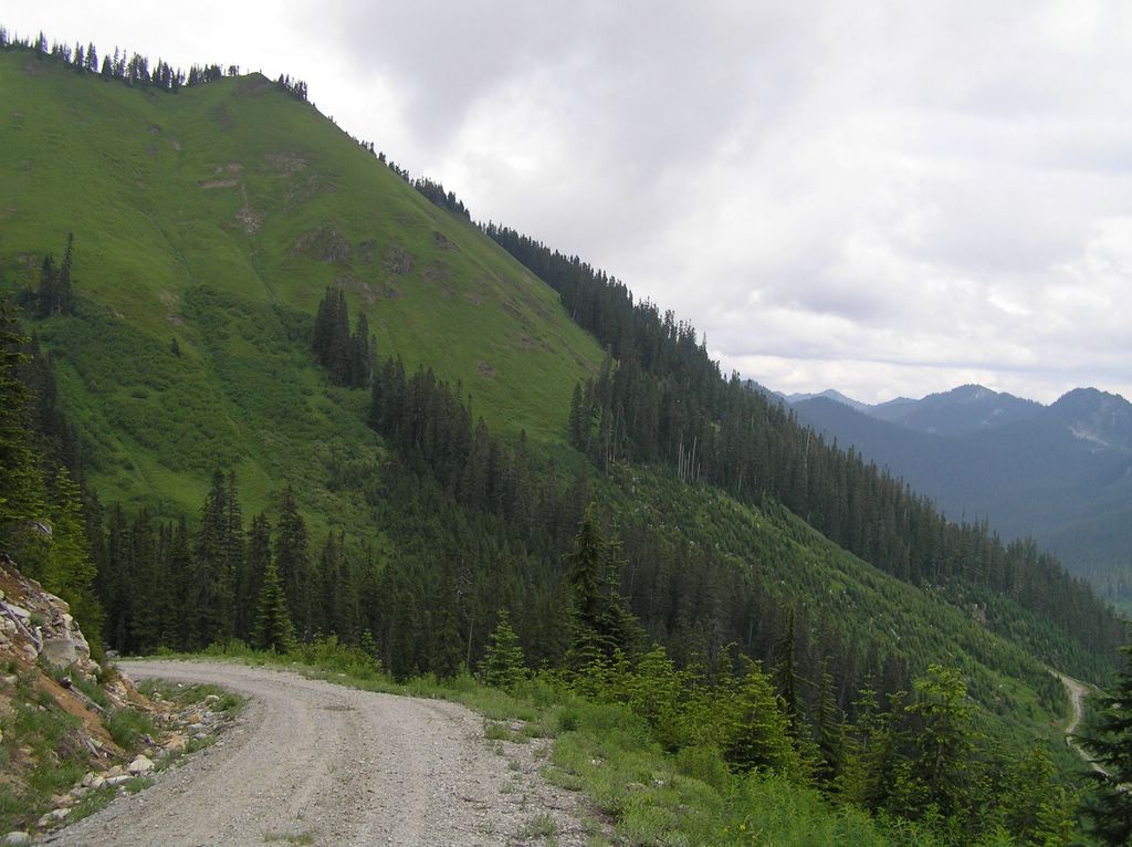
Captain's Point is at the end of a seldom-used looging road above the Marten's Creek Valley beyond the Iron Goat Trailhead. The logging road is approx 3 miles one way with moderate slope. The road for the most part hug the east slope on the way up . . . making this an ideal early morning hike to take advantage of the sun. All the way you are presented with open vistas of the valley below and when you reach the end of the road at Captain's Point you can look out over the Skykomish Valley way below and spectacular Mt. Fernow to the southwest.
Birds abound, including grouse. Early on, there are opportunities to check out old construction equipment still on the road . . . including a crane perched crazily on the road.

The road is sometimes gated . . . and sometimes that gate is left wide open with seemingly abandon. The last time I hiked this road, we were startled by a beat-up car heading down . . . nothing official, I'm assuming someone up there exploring. For the most part, this area is seldom visited. On subsequent hikes I haven't seen any indication of activity. This makes this gravel road a great place for a nude hike with plenty of sight distance to cover up if wanted. You won't be surprised on this route!
To get there, take the turnoff on Highway 2 to the Old Cascade Highway (FS #67, N47 43' 5.81" W121 13' 53.24") and continue up 2.3 miles to FS #6710 (N47 43' 11.31" W121 11' 10.61"). Continue up this FS Road, avoiding the potholes in the lower section, for approx 1.4 miles to the Iron Goat Trailhead (N47 43' 46.93" W121 12' 24.27"). Take a toilet break here if necessary.
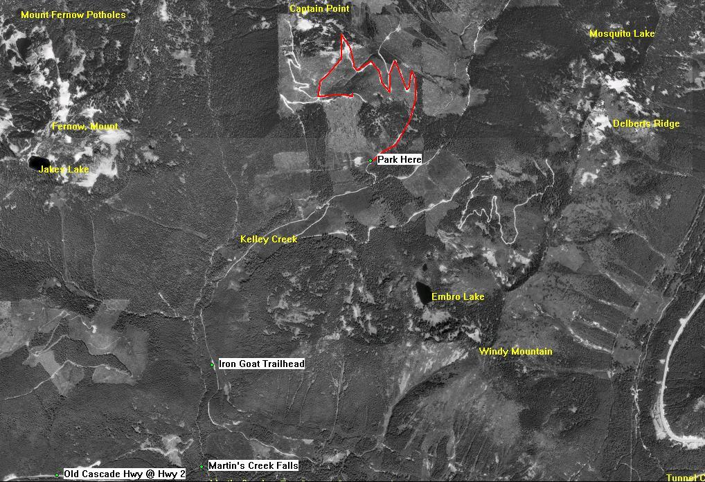
FS #6710 continues past the trailhead. Continue up another 2 miles to a junction or Y split in the road (N47 44' 52.35" W121 10' 52.89"). You will just be able to see a one lane concrete bridge over the stream to the right. This is the fork you need to take. Continue for anothe 1/4 mile past the bridge and park to the side where another logging road T's.
Now is the time to get naked but do it inside you car and apply bug spray now because this close to Kelly Creek the biting gnats swarm for warm bodies. Once on the road this is no longer a problem. The hike is straight ahead with 7 road switchbacks amid spectacular views. Enjoy.


|