Nude Hikes Overlooking the West Foss River Valley
Note: This post took some time to put together because I simply did so much hiking during that period . . . so much that this is only a small sample of the great time I've been having. I wish I could post about them all . . .
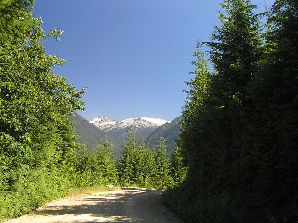
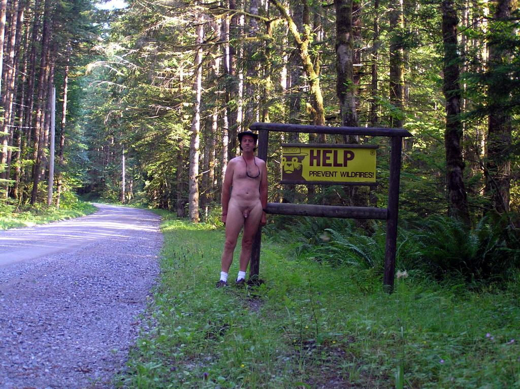 Entering Forest Service land along the approach to the Foss River Valley on FS 68
It's been a busy week with all this great weather . . . and I haven't been remiss in my hiking, plus fitting some time in there to visit LARC for the Music Fest last Saturday. The thrust of my explorations has been the Foss River Valley with a lot of little side trips exploring spur roads but three noteworthy hikes to:
- An unmarked and abandoned logging road up the west side overlooking the Foss River valley
- Sobeiski Mountain features a microwave tower at the top and overlooks Maloney Ridge
- Evans Lake, an easy, and popular, 1/4 mile hike to a small alpine lake and great camping places
The Foss River Road turnoff just past the Ranger Station on US 2, is mainly known for the Tonga Ridge trail access. I've explored beyond the spur road that takes you to Tonga Ridge and checked out a few areas at the far end of that FS road (which terminates at a blockaded bridge over Fisher Creek). That is the east side of the Tonga Ridge/Mt Sawyer Formation and until the deer flies disappear, I don't plan on anymore hikes in that area. This time, I explored the opportunities east and south of Tonga, all of whom are accessed by continuing to the right on FS 68 instead of taking FS 6820 on towards the Tonga.
A Gem of an unmarked logging road
There are lots of unmarked dirt and gravel roads leading off of FS 68 as you wend yourself into the wilderness. One such one I drove up quite distance to see where it went before I started getting nervous about being able to turn the car around on the narrow, unused tracks in the dirt. The first time I backed down almost half a mile close to the entrance until I found a place to park near a pretty creek coming down the hill. I spent some time exploring that area with the idea of doing a nude hike sometime in the future.
 Exploring the burned-out core of an ancient tree
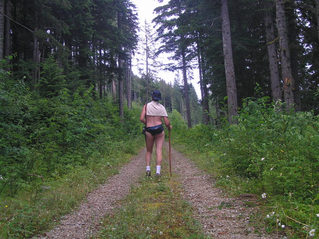
The second time I visited this area I again parked a couple hundred feet in near the creek and out of sight of the entrance. This time I was going to do the entire road and hike it nude wherever it took me. I had no idea since it didn't show up on my top maps. It was starting out to be a nice day with the morning chill beginning to burn off, so I stripped and took only a fanny pack and a hiking stick. And off I went, an easy stroll along the two tire ruts and a lane being edged in slowly by the bushes.
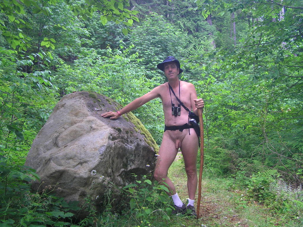
Heading up the logging road with just a fanny pack, a teeshirt over my shoulders against the morning chill, my hiking staff and, of course, my floppy blue hat
 Reaching the end of this logging road through the couple of switchbacks through a number of grown-over clear-cut areas leads to some wonderful views of the Foss River Valley far below. If you look real carefully through binoculars you can make out the Foss River Campground at the confluence of the East and West branches of the river on the valley floor . . . and possibly make out a few tents. This road ends in a wide turnaround before a deep ravine. A few old campfires and numerous shotgun shells along with the typical discarded food wrappings show that the irresponsible have been up here in the past.
The hike back down is just and enjoyable and I spend a lot of time dawdling over ripening wild berries edging the side of the road. Down near the first switchback I get that edgy feeling again when I know a hike is drawing to a close and I have to get dressed again. Always happens to me. Not nervousness but a disappointment . . . something that makes me think about just turning around and hiking all the way to the top again. Anything to avoid that last stretch back to the car and the end of the hike.
This time, however, I go off the road toward the sound of rushing water over the slope. I can hear it and perhaps just make out evidence of the deep cut, but the forest is sly and thick here. I wonder . . . is it possible to approach the stream from below.
When I had headed up the road showed evidence of a real old track (two ruts) barely discernible Y-ing off just before the switchback. Here was my diversion. I hung and sharp right and headed down a completely overgrown old road toward the sound of the stream I have been looking for.
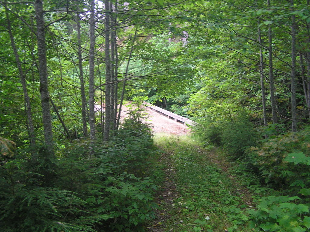 Imagine my surprise when I came to a wooden bridge, car width, out in the middle of nowhere. You couldn't see it from the road, the spur was something no one who think twice about exploring. Yet here was that bridge; in great shape . . . huge granite boulders sitting moss-covered in the middle . . . undisturbed for years.
The Forest Service has a habit of marking decommissioned and abandoned bridges with obvious markers. None to be seen. Was this road truly forgotten? It goes no where but a few hundred feet more through heavy brush and then peters out. But I have a creek and bridge to play with now. I love getting down into the streams and creeks. Then just fasinate me.
 Eventually, I head back as the sun begins the wane and the bugs start looking for a meal. The last mile or so is sedate and quiet. My car comes into view and I know I've communed well with nature today.
How to get there:
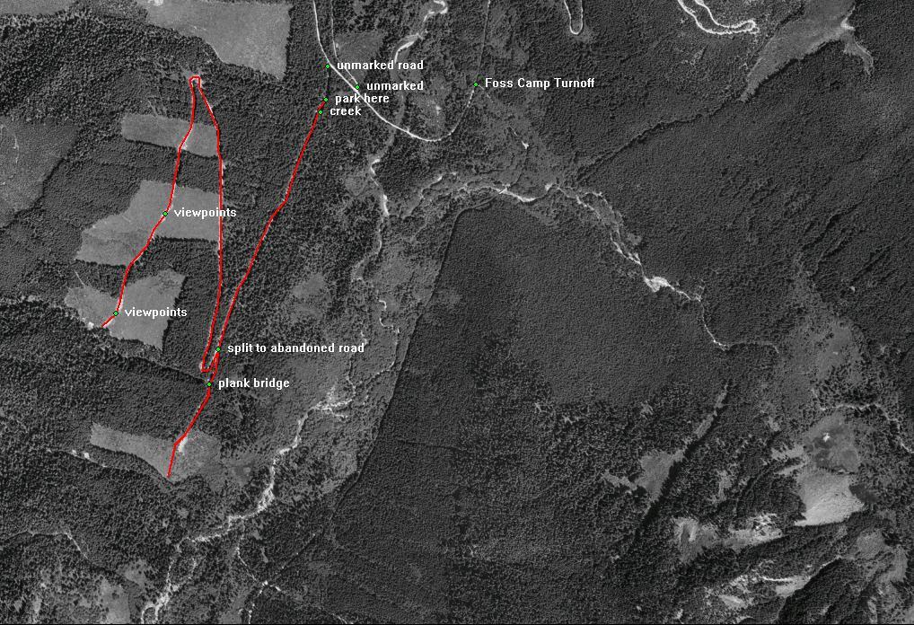
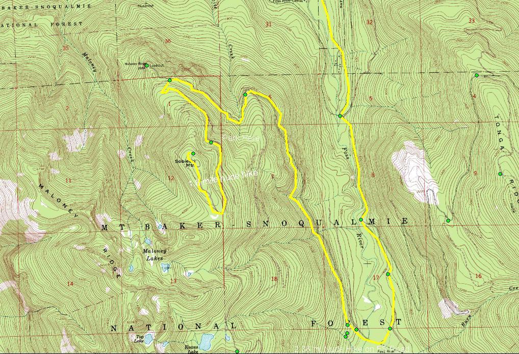
Logging Road Over West Foss River Valley:
- From the turnoff from US 2 onto the Foss River Road you will go over the Foss River on a one lane bridge t about one mile in.
- You will pass under the BN RR trestle at 2.4 miles
- At 3.5 miles, continue straight ahead on FS 68 (the right fork). The left fork is FS 6820 which leads up to the Tonga Ridge
- Continue past the parking area for Trailhead 1064 at 4.1 miles
- FS 68 curves back north, crossing a creek by a small bridge and then the Foss River by a second bridge at 5 miles
- You will pass an unmarked abandoned dirt road on the right, closely followed by another unmarked narrow gravel road T-ing on the left at 5.25 miles.
- Turn left on this road for about 500 ft and park just before the flood-sluice structure for the creek. It is possible to drive a considerable distance up this road and a 4x4 would have no trouble reaching the top. Best saved for hiking, though.
- This hike is 6.5 miles round trip

Sobeiski Mountain Road
The peak named Sobeiski is just about at the end of FS 68 with the last major fork being the route to Maloney Lookout overlooking the Skykomish Valley and the town of Skykomish to the north. Of course, I hadn't really studied my maps that much when I set out on this adventure; I was just following the gravel road . . . soon to become a torn-up dirt road . . . to it's natural end somewhere deep in the wilderness between Highway 2 and Interstate 90. I guess I harbored some secret wish to shortcut the 35 mile length of the Stevens to Snoqualmie leg of the PCT by starting in perhaps halfway there to Snoqualmie Pass. No such luck. The road climbed steeply and eventually became just a little too rough for my Civic to easily continue. So I parked, thought about it and then decided to hike as far as I could on this remote road. In the distance I could see a microwave tower and already had some inkling that that was where this road lead. Off I went sans clothing and enjoying the bright sunlight on the open slopes.

Turn the car around to point downhill as this is as far as I can safely drive. Now it's time to enjoy a hike!

Perfect hiking weather and a complete sense that you have this all to yourself
I believe it is called Cathedral Rock, a prominent outcropping south as I approach the top of Sobeiski
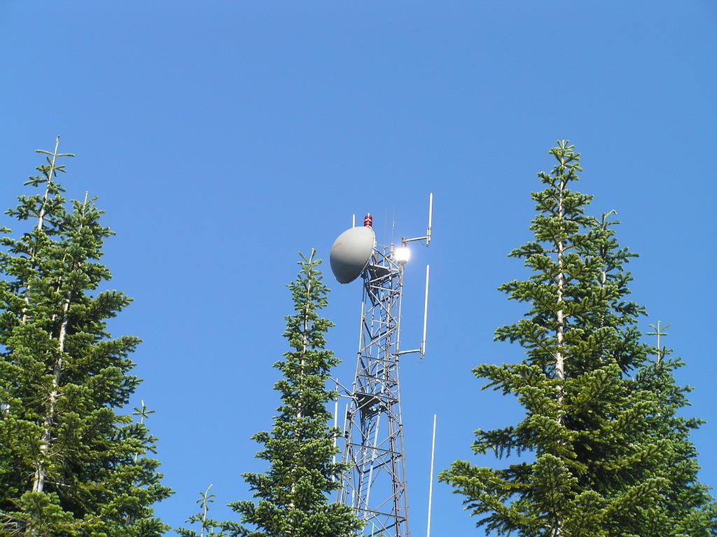
The microwave tower atop the peak is completely automated. On several sides you can see the fiber-optic cable snaking their own perilous route up the steep slopes.
There is lots of space atop Sobeiski . . . certainly flat camping areas and fire-rings that indicate this is a popular camping place, although the pits seem disused for some time.
On the northern-facing side is a great view of the Skykomish Valley twenty miles down and north. In the distance is the Glacier Peak Wilderness. The dirt road circles around the high, treed mound on which the tower sits and then rejoins the road I just came up on. It's a long time before I feel any need to head back down.
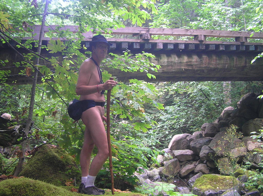
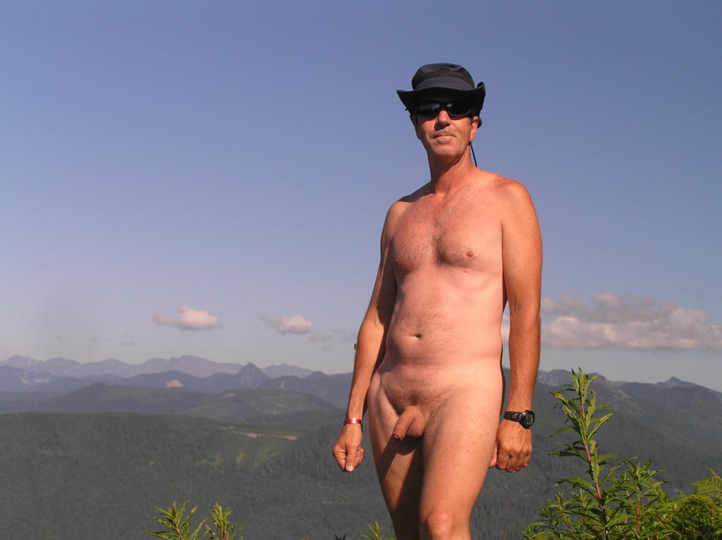 Okay, I admit I'm a bit narcistic about myself in this pic. My tan is developing nicely, I feel healthy and good about myself and this picture reminds me of that. I'm truly at the top of the world!
How to get there:
Logging Road Over West Foss River Valley:
- From the turnoff from US 2 onto the Foss River Road you will go over the Foss River on a one lane bridge to about one mile in.
- You will pass under the BN RR trestle at 2.4 miles
- At 3.5 miles, continue straight ahead on FS 68 (the right fork). The left fork is FS 6820 which leads up to the Tonga Ridge
- Continue past the parking area for Trailhead 1064 at 4.1 miles
- FS 68 curves back north, crossing a creek by a small bridge and then the Foss River by a second bridge at 5 miles
- Continue past the previous unmarked road at 5.25 miles. At 8 miles is the Y of the Evans Lake Road to the left. Continue on FS 68 to the right.
- At 9.1 miles take left fork (right continues to Maloney Lookout)
- You can safely drive about a mile up this road. Find a spot to safely pull over and park and begin your nude hike from here, which leave about a 3-4 miles round trip nude hike, mostly in full sunlight.

Evans Lake
The third hike is to the very popular Evans Lake Trail . . .
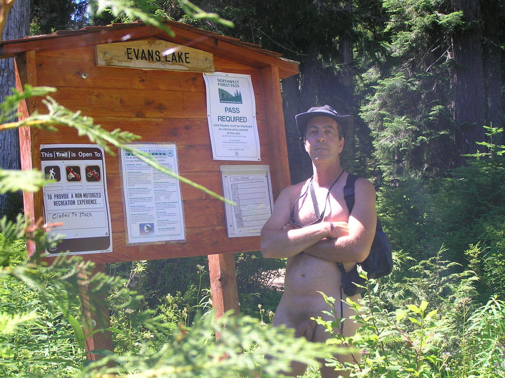 Heck, you knew I was going to pose with the trailhead sign, didn't you?
I didn't know what to expect of Evans Lake as it's touted as an extremely easy trail suitable for all ages from children to seniors. But this was a weekday so I figured maybe I might have it to myself. So off I went, driving naked up the miles of Forest Service roads to the small siding that served as the parking area for the trailhead. I missed it the first time and continued another half mile up to the end of the road. The signage is off-road but obvious once you see it. Along the way you have some extraordinary views of the Necklace calderas facing the Tonga Ridge to the northeast.
 This view is alongside the FS road about halfway up
There were no cars in the siding so I felt confident about hiking in nude. I few pesky deer flies this high up on a hot, sunny weekday but not anything I couldn't handle. The trail is a short, level stroll of a quarter of a mile to the lake . . . and possibly another quarter mile in narrower trails around the lake. The lake, itself, is rather small but scenically nestled between the close steep slopes of the nearby peaks.
 Lake Evans is shallow and perhaps an acre in size
Reaching the lake, the trail becomes a scramble to the right perhaps a third of the way around the lake, over fallen trees and encroaching blackberry bushes. It is in the southern side of this lake (to the right) where you find all the idyllic camping spots. I spent a lot of time sunning in these areas or just relaxing.
The return drive down presented those stunning views of still snow-caps peaks south of Tonga . . . better yet, I got to drive the 8 miles back naked.
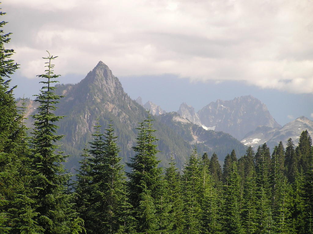
 The aptly-named Jewel Peaks


|