Sunset Mine/Trout Creek Again
Well, I was cheated on my last visit to Sunset Mine when I judiciously backed off from a bunch of target shooters. But what glorious weather we had this weekend . . . temperatures approaching the sixties and clear skies. On Saturday I hiked up to the Sunset Mine site and did a lot of exploring around to GPS the positions of the adits and stoves. Remarkably, I saw nary another soul the full eight hours I was stumbling about in the brush above the mill site.
Sunday I decided to hike the full trail . . . never having taken it all the way to its' end before, and knowing nothing about what to expect in the way of trail conditions. I encountered one other hiker returning from the end and we had a nice chat about other hidden trails in the area. My nudity fazed him not in the least bit.
So, confident on the viability of this trail for a nude hike, I created my next Google Interactive Map for others to explore the area and perhaps make a visit.

 A very old and dilapidated wooden bridge
(I didn't dare step in the grassy strip)
Once you pass the concrete foundations of the old mill site things start to get interesting. Most hikers never go beyond those foundations . . . they've found the mine, the mile and a half was steep and tiring . . . they turn around and go home. The best is waiting just beyond. Like this old wooden beam bridge that I barely trusted my own weight to, let alone a vehicle. The bridge seems substantial and I'm sure it was 63 years ago when the mine closed. Now it creaks and groans under my modest weight and that grassy section . . . there is nothing under it but decomposed timber. My foot almost went straight through!
Where the road goes on the far side of Trout Creek I have no idea, not having explored the area. The mine did have a dam at the outlet of Sunset Lake on that side and it would seem to be the approach if one needed to haul equipment down the South Fork of Trout Creek. No maps show this spur road, though my topos do show a timber clearcut on that side. So perhaps it is a boring logging road.
Update: Seems there were some mineral claims further up the south fork of Trout Creek and this spur road seems to align with another ancient mining road/trail to the camps and prospects of Merchants claim.
There is a great campsite right next to this bridge as well as a few other campsites secluded around the area. This one is spacious, very level and has a nice campfire ring. Someone has thoughtfully stocked cut firewood in the area. This is about as far as a 4WD vehicle can make it up this road. An ATV would be advisable to go further in.
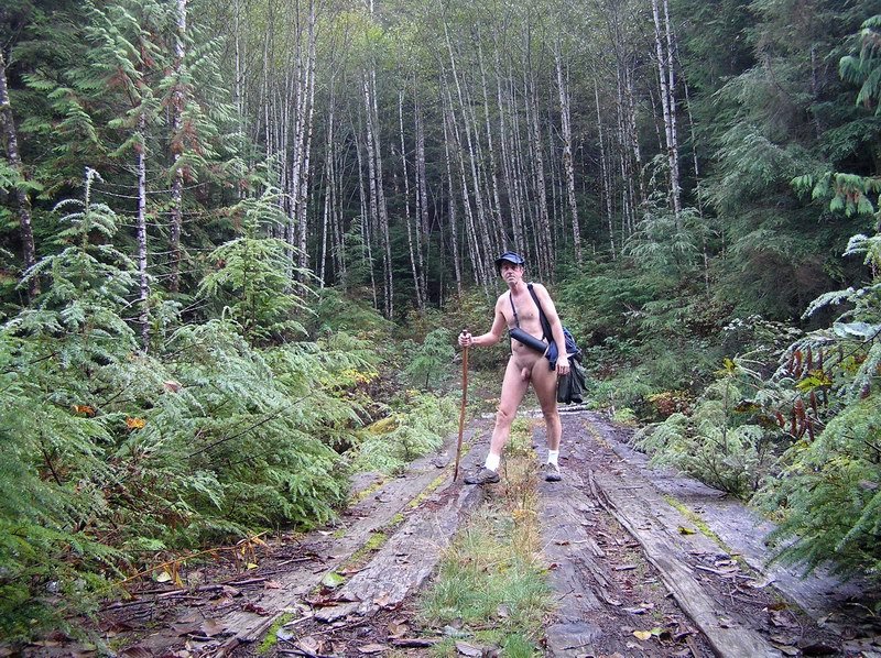
 The mine entrance of Adit #2, the lowest
Exploring the mine entrances (adits), stoves (collapses) and cuts is hard work because the new growth quickly obscures everything. So many explorers have been up in the area that the multitude of social trails is confusing. I found the other two adits (#1 & #3) with a lot of body-scratching scrabbling through autumn-denuded brush . . . and almost fell into the stove above #2. I will wait for next summer to properly explore this area once again.
 Spectacular fall colors!
 Climbing out of the Sunset Mine area for the rest of the trail
The trail beyond the Sunset Mine site is pleasant. It is nice and wide (being an old mining road) and for the most part at a reasonable grade uphill. In the four miles in, you gain 1,400 ft of elevation (most of it before the mine site). However, there are a lot of road cuts, collapses and wet, soaked sections that will stop vehicles. I felt very comfortable nude hiking the portion beyond the mine.
This was the area I had my encounter with a returning hiker. I knew someone else was on the trail simply because there was one other car parked down at the bottom. I figured whomever it was would be exploring the mine area and gave it no more thought . . . especially after relaxing for the second leg of the journey in. Like I said . . . the encounter was a non-event for both of us and as we parted ways I gave it no more thought. I was enjoying the outdoors.
This was the area I had my encounter with a returning hiker. I knew someone else was on the trail simply because there was one other car parked down at the bottom. I figured whomever it was would be exploring the mine area and gave it no more thought . . . especially after relaxing for the second leg of the journey in. Like I said . . . the encounter was a non-event for both of us and as we parted ways I gave it no more thought. I was enjoying the outdoors.
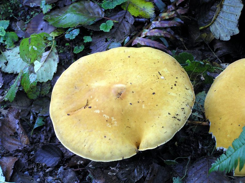 Mushrooms! Yumm . . .
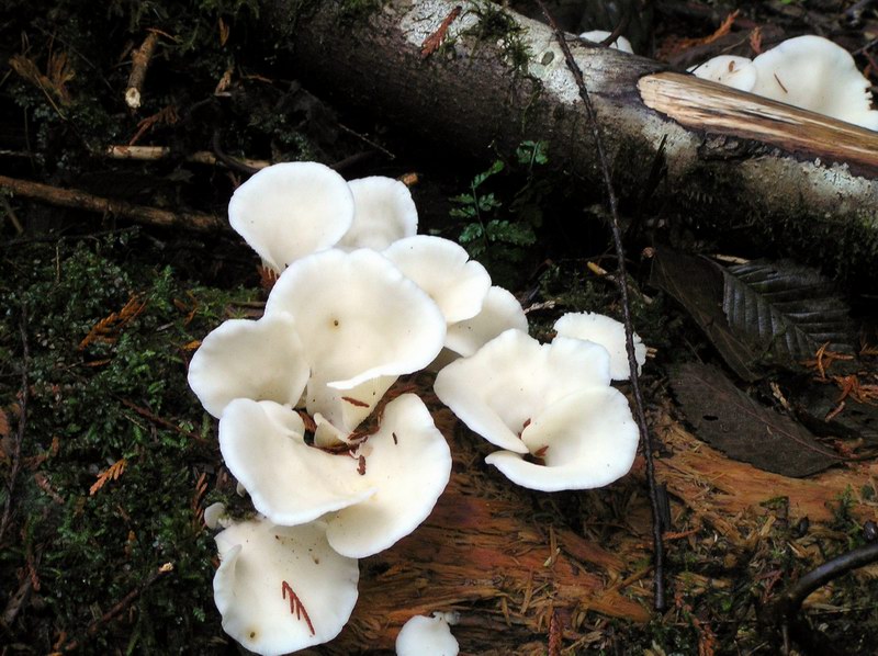 . . . or maybe not. I haven't the faintest
idea of which are the good ones
I spent a lot of time just daddling around. I wish I knew my mushrooms. I've had people try to explain them to me before but there are just so many shapes, colors and wrinkles. But they are pretty.
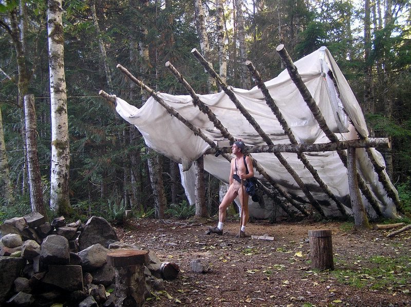 Someone went to an awful lot of trouble
to build this huge lean-to at the end of the road
I was forewarded about the lean-to. I didn't expect this massive a structure. It might be functional but it was ugly to me. The plastic sheeting destroyed the essence of the place. Other than that, the end of the road is a great camping spot . . . flat, dry and scenic. The firepit has got to be one of the biggest ones I've ever encountered in the wild.
The road devolves into several trails at this point. One heads steeply downhill to a 'ruins' site . . . perhaps the reason this mining road was extended in so far. The second takes you to a steep cascading waterfall that I spent some time enjoying. There appears to be a trail on the other side but checking it out for several hundred feet, the tread is faint and indistinct. I don't know where it leads.
Update: The trail does indeed lead down to a 'ruins' site that was once a coffer dam controlling the waters from Sunset lake. Even more interesting is that the trail (indistinct as it undoubtably is) follows up the south fork of Trout Creek another three miles and passes a number of old mining camps and mills. That makes this trail a little over seven miles one-way, with a lot of pathfinding and buschwacking. At the far end is supposed to be the ruins of a mining tram that rode a thousand feet up the side of the valley to a working claim. Interesting hike for next season.
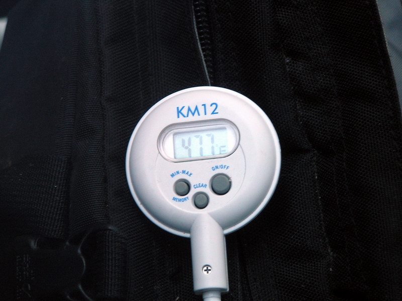 Might have been 64F in Sultan but up in the mountains
the temps were dropping below 50F as the day progressed
I'd started my hike in at 10 AM. Four miles is a two hour hike for me but I'd dawdled about exploring so much that I'd been in the wilderness for close to six hours before I decided to turn around and head back. All of it had been nude and now the sun was sneaking behind the ridges and the temperature definitely dropping. I was beginning to feel the chill.
 Kinda cheating but it does take the chill
off near the end of a 7 hour hike
Sometimes when I night-hike I will wear a loose top just to take the chill off my back. It doesn't take up too much room in my pack. It feels slightly like I'm cheating the pure nude experience but it's functional. Besides, I wear shoes and hat . . . and sometimes gloves.
The top can be pulled up to stay 'mostly nude' or . . .
The top can be pulled up to stay 'mostly nude' or . . .
 . . . and it can be pulled down quickly
to cover myself if needed (it wasn't)
. . . dropped to cover myself if needed. I've never used it this way and certainly don't put it on for that purpose. Five . . . ten minutes to take the chill off, and then it's back to straight nude hiking the way it should be done to enjoy the freedom and whole-body awareness it gives you.
Some hours later I'm back at my car I standing around nude. I'm unable to bring myself to pulling on some clothes and heading home. Is winter soon to be upon us and the hikes like today's and Saturday's a thing of past seasons? It is a long time before I force myself to unlock the car doors and sit down to unlace my shoes. Time to cover myself up. I'm dreaming of spring and summer and the returning sun again.
Some hours later I'm back at my car I standing around nude. I'm unable to bring myself to pulling on some clothes and heading home. Is winter soon to be upon us and the hikes like today's and Saturday's a thing of past seasons? It is a long time before I force myself to unlock the car doors and sit down to unlace my shoes. Time to cover myself up. I'm dreaming of spring and summer and the returning sun again.
Tags:


|