Lewis Creek Nude Hike
With the break in the weather between rain and snow storms, I wandered off into the mountains to check out conditions for myself and maybe sneak a hike in. For the earlier part of the day it rained and drizzled on and off but there were promises of a clearing.
Snow pretty much above elevations of 2,400ft and with wet rain and snow, and gusty winds, I was not in the mood for hiking naked in that stuff. But lower down in the Index area, the Sunset Mine trail was a distinct possibility . . . even as much as I've hiked that old mining road the last few weeks. There just weren't too many other options that didn't involve wet, chilling snow. Problem was, the news reports warned of major flooding and washed away roads at the six and a half mile mark of the Index-Galena Road. Six and a half miles is just short of Trout Creek and the Sunset Mine Trail. Did I even have a trail left to hike on, let alone access to the Trout Creek area?
Seems I didn't, though as I drove and got closer I kept my fingers crossed the the road closure would be on the far side of the trailhead. I wasn't . . . the barrier of red warning cones was one bend short. The Index-Galena Road was washed away right in the vicinity of Trout Creek. Major repairs needed and no hike down this direction.
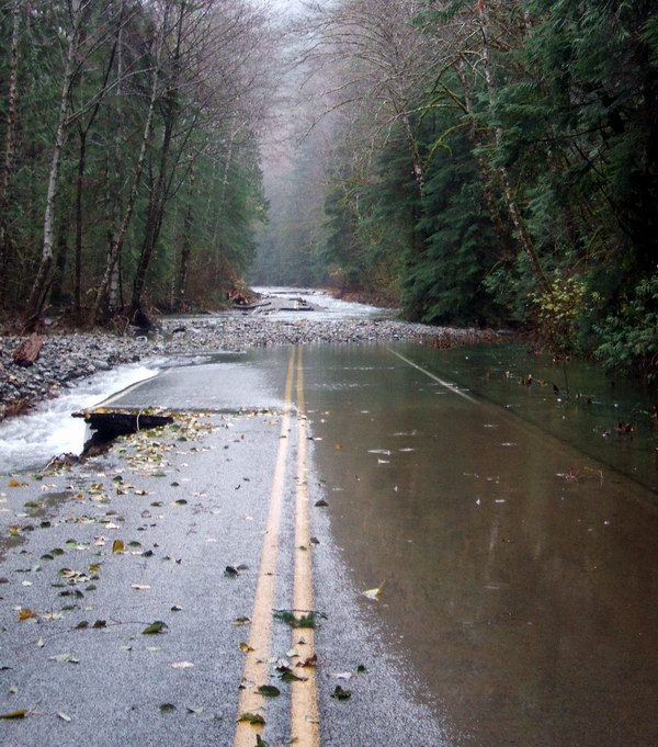 The Index-Galena Road looking north at Mile 7 from SR 2.
The North Fork of the Skykomish is to the left.
The water is coming down off the extremely steep
slopes of Iron Mountain on the right, as well as
flooding attributable to Trout Creek. The campgrounds
are a mess. The trailhead access to Sunset Mine is
about midpoint on the right, where most of the water is coming from.
I wasn't the only person checking out this damage. Among others was Andrew from the Washington Trails Association, to whom this picture is attributable. The weather was miserable enough to dispel any immediate thoughts of hiking nude. I was just grateful that my jacket actually kept me warm and dry, and that my boots were waterproof.
However, wandering about in the rain had it's moments. At least I wasn't cooped up inside. Eventually I walked back to the road barriers and settled in my car with coffee, seemingly done for the day. I started driving back toward SR2 and Seattle in a new, fresh downpour.
I hate to be denied a hike. Especially since I hadn't had one in a week. Impulse made me turn into a large cleared area a few miles down the road. I'd seen the clearing before, along with the occassional car parked near the FS gate. Never investigated it though so I pulled in to check it out. No one else was there . . . not that anyone else on the planet would want to hike in this kind of wet weather. I didn't have my charts with me so I didn't know where the one-lane, beat-up gravel road beyond the gate went. Nothing ventured, nothing gained. Perhaps a future hike. I got out of my car, dressed to stay warm and dry. Just a look-see.
 Not a good sign. Fissuring and slumping
of the roadbed just before the gate
Since I hadn't brought any charts with me, I just referenced it by the bridge just a little ways from the turn . . . Lewis Creek. Later, looking it up on the charts I figured out it had to be FS 6310 and the creek more properly named as Canyon Creek. By the time I figured that out I'd already made a Lewis Creek Trail map
 Lewis Creek Trail is properly known as FS 6310,
an unmaintained and gated logging road that
switchbacks 3.5 miles up with a gain of 2,000ft
to the headwaters of Bitter and Boss Creeks
below Jumpoff Ridge
The slumping of the roadbed just before the gate was fresh. Just beyond the gate you could see deep scouring and etching of the roadbed . . . all fresh erosion. The gate, itself, has been here for awhile, the lock inside the steel post old and thoroughly rusted. There is a hiker/mountain bike walk-by so I assume that this road is popular with mountain bikers. None were here today. I walked up about a quarter of a mile and knew this would make a great nude hike. I kept thinking that to myself as I walked back in the drizzle.
Back at the car I waffled as another session of steady rain came down. I drank coffee from the thermos and just couldn't seem to give it up and just go home. I wanted a hike! It didn't feel that cold . . . the rain, I suppose. Still, it had to be in the upper thirties and wet. Not good weather to be nude in for any length of time.
But Mother Nature and the weatherman smiled on me . . . the rain stopped. Still bleak and misty looking out. I got together my hiking gear (the pack, clothing, thermos and hiking staff). Unfortunately, I hadn't brought my lightweight and less bulky rain jacket . . . instead I had a very bulky lined Eddie Bauer parka. It would have to do. At least I'd be glaringly visible to any hunters roaming about, though I didn't think they'd be out in this weather either.
It's funny the amount of dressing one does to go on a nude hike. At least, I thought so as I undressed in my car, removing three layers of clothing and then putting the outer shell back on knowing that within minutes, once out of sight of the main road I was going to remove them again. I put on a pair of warmup pants with snaps all the way up both sides . . . easy to get in and out off without hopping around trying to get my large hiking boots through. The parka was big and bulky in itself. I decided against any other clothing and just zipped the coat over my naked torso. Coat and warmup pants; gloves, hat and shoes. I was too lazy to put the hiking boots back on. Besides, it wasn't raining anymore. It wasn't 50 feet before I was overheated. The clothes came off soon thereafter.
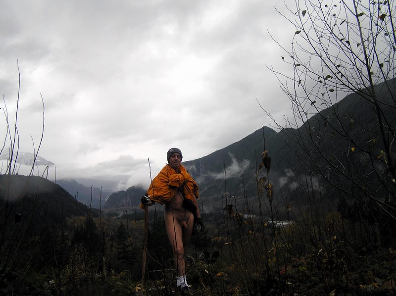
 Not my regular jacket that I prefer when hiking nude.
Much too bulky to roll up into my pack. But it is a 'safety orange'.
It is a little nippy out, particularly since I'm near Canyon Creek and catching the moisture-laden cold air that favors mountainous creek beds. Small things preoccupy my nude time . . . like what to do with the jacket . . .
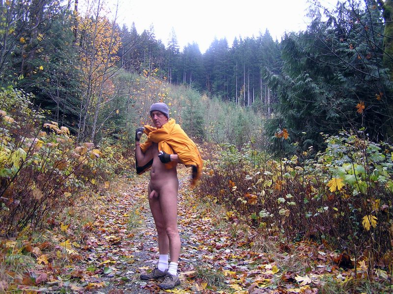 . . . what to do with a jacket that is bigger than your pack
 . . . the only practical answer (besides stashing all my clothing somewhere along the side of the trail to hike trully nude - stupid idea but I actually entertained it), is to sling it over my shoulders and wear it like a cape. Gaining altitude, this turned out to be a good decision. I didn't know anything about the road other than what was immdeiately in front of my eyes. I definitely didn't know about the steepening road and the 2,000 ft gain in elevation before me. Meanwhile, the road before me was a gentle bed of autumn leaves that once beyond the first few hundred feet was in pretty good shape.
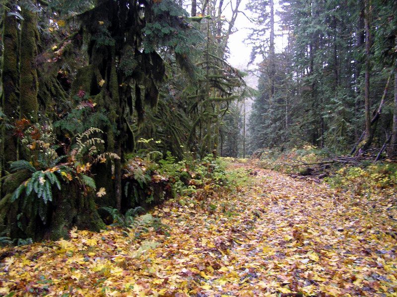 Hiking in autumn is serene
 The jacket is handy to have. It goes on and off with the wind gusts.
Beyond a couple of wide and long switchbacks the road steepens. The weather is nippy, especially in the un-logged areas that take me through dark shade, or an exposed clearcut on the southern slopes in line with an advancing storm front. It's an unusual sensation to have my back toasty warm while the rest of my exposed surface tightens in response to the cold. Hot and cold sensations contrasting.
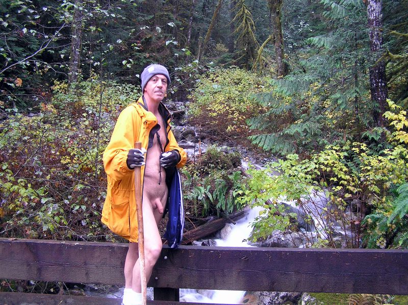 Crossing the wood deck bridge over Canyon Creek
After a bridge crossing and one more major switchback the road becomes extremely steep . . . in some stretches up to 40-45 degrees. I could see how this road would be a popular mountain bike route . . . imagining in my mind the hard-toiling bikers doing a turn-around at the top for the joy ride of their life barreling down these steep sections. As I, myself trudge on up higher I'm beginning to wonder to myself if this is not a backdoor route onto Heybrook Ridge to the south. The next switchback to the north tells me otherwise and I trudge steadily upwards for almost another mile. The mountainside really steepens. There are some great vistas over the North Fork valley below.
 Just below a sharp series of switchbacks and the beginnings
of snow on the ground . . . and in the air.
Passing through 2,600 ft and the switchbacks, the road is no more than a footpath now. Late afternoon frost coats everything and not far ahead I can see patches of snow. I'm glad I have the coat with me and over my shoulders. The air is close to saturated and the temperature dropping. The mist of clouds is hugging nearby slopes, including the one I am on. I don't feel cold . . . I'm sure the jacket does a lot to keep my core heated. Gloves are an absolute necessity and I'm thinking about putting on the warmer pair.
Nonetheless, I'm losing the light and have at least an hour to an hour and a half hike back down. Reluctantly, I survey the scene for a few more tantalysing minutes with thermos dispensing hot liquids. Then it's back. The gate is upon me sooner than I expect. I almost fall into the eroded gully that claimed half the road before the gate. I reach my car, electing to hike nude all the way, well after dark . . . and without the headlamp which I had mistakenly not repacked after the last use. I'm not quite sated but certainly glad to have let impulse drive me to turn off onto an otherwise insignificant dirt road. FS 6310 (my Lewis Creek Trail) is a great nude hike.
Recommendations to hike this trail nude: This is an obvious trail bike route. The bypass on the gate alone attests to that. However, the trailhead is far enough away from civilization that you can assume no cars . . . no hikers or mountain bikes. There is also great sight distance both inbound and outbound. Hard to be surprised by an inbound hiker or bicyclist. Once past the wood deck bridge the road gets very steep. You'd have to be a fanatic biker to go up much further.
Beyond the last series of switchbacks you are headed into the Wild Sky Wilderness (pending). The trail is getting indistinct and I'd expect you to have that area all to yourself. This is westerly, turning to northerly exposure. Afternoon sun is the best. Morning will put you into shadow.


|