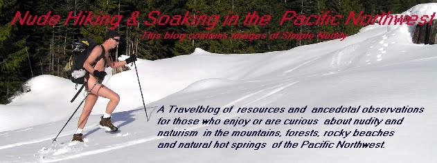
Boss-Bitter-Canyon Creek Snow Hike
 Last Saturday was a great day . . . Sultan temperatures in the mid-50s and sunshine out. Sunday was also my birthday so I gave myself an early birthday present and headed out for a hike . . . a return to the Boss, Bitter and Canyon Creek Road. The road is gated and closed, and parking limited to one space near the gate. Perfect for a nude hike!
 I was out of my clothes by the time the Index-Galena Road was out of sight. A little cool at first under the shade of young alder. But hiking soon revs up your metabolism.
The road is level and wide in the lower sections. An easy, slow and enjoyable naked amble. Soon the trail steepens into several long switchback as it climbs the mountainside, crosses over Canyon Creek and then turns back in a northerly direction, snaking back and forth across creeks and waterfalls.
 There is a lot of blowdown on this abandoned road, the size of the trees getting progressively bigger the higher I trek. The road is also being reclaimed by young alder shrubs that at times are a challenge to weave through. The nude body takes a few scratches here and there from whipped-back saplings. In some places you wonder if a trail or road is still there. Only the open sky above the hidden roadbed reassures you.
Soon after the last of this series of long-legged switchbacks I cross an unnamed creek that has essentially destroyed the roadbed. Getting across the creek is an excerise in stone and downed tree trunk-hopping. I get across dry and unscathed, and stop to enjoy the afternood sun . . . so warm on my skin . . . and a cup of coffee.

Into the next series of switchbacks . . . steep climb and short legs . . . the road is a mess of downed trees like those above. I almost turned back, unsure if I really wanted to do the scrambling and climbing necessary to get across.

Soon I'm into the snow . . . no tracks here. I'm trekking virgin territory since I was last up here in November. The snow is packed and firm. I opt to leave the snowshoes strapped to my pack. The road starts swinging around the flank of the mountain to the east and the Bitter Creek Valley.
 Bitter Creek should have gotten the Canyon Creek name. These are the absolutely vertical shale walls that define Bitter Creek all the way back down to the NF Skykomish River Valley a thousand feet below
Ahead the road runs straight and wide. Jumpoff Ridge is straight ahead overlooking the Bitter Creek Valley.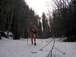

The limit for today if I want to get back before nightfall. I dally in the valley trying to find the Boss Creek Spur Road without luck before turning back. A great day in the mountain all to myself. Seven and one half hours nude time, 1800 ft elevation gain, and close to eight miles round trip . . . not a great backpacking pace but it's the trip that counts . . . not the destination.

Tags:


|